The Port Stanley Waterfront Master Plan
Consultation has concluded
Welcome to the Municipality of Central Elgin’s Port Stanley Waterfront Master Plan Community Consultation Hub!
The Municipality of Central Elgin understands the importance of the Port Stanley Waterfront to both residents and visitors. The Municipality along with Thinc Design and Riel Cultural Consulting is developing a Waterfront Master Plan for the Port Stanley Harbour Area that builds on the recently approved Port Stanley Harbour Area Secondary Planning Study. This Master Plan will, in consultation with the community, determine the future use and configuration of the harbour community facility area over the next 15-20 years.
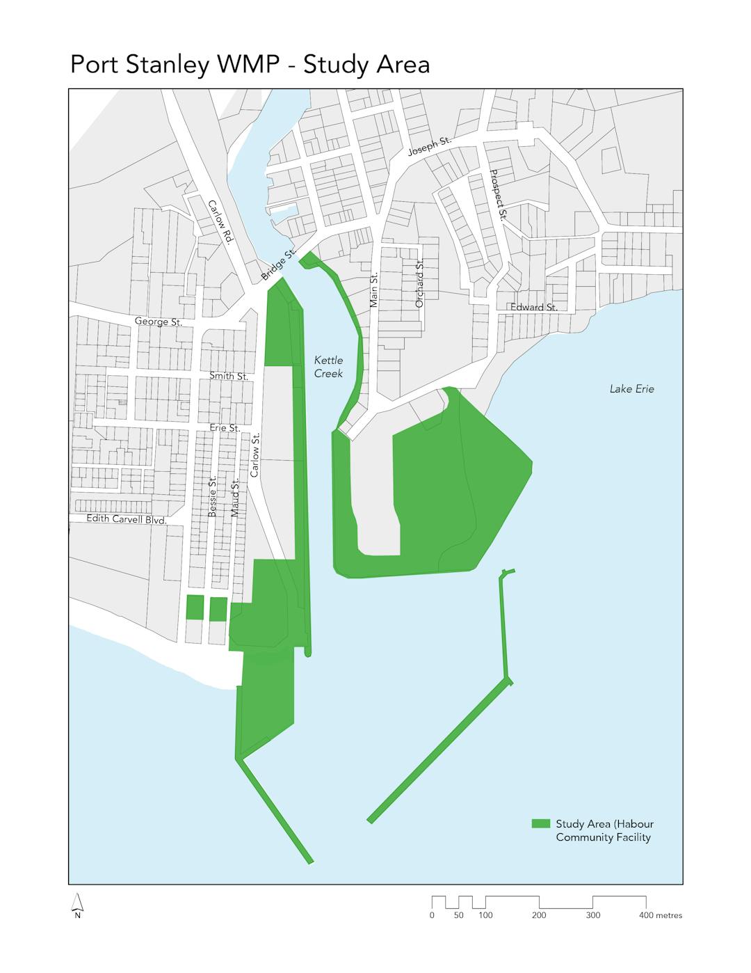
The Master Plan study area is comprised of approximately 13.6 ha of public realm space, which includes the waterfront lands south of Main Street, as well as lands east and west of Kettle Creek south of Bridge Street. This includes the West Breakwall, Hofhuis Park, and West and East Pier Walkways.
The Municipality of Central Elgin wants to develop a Master Plan that will best serve the community, which means we want to hear from YOU to find out about waterfront services and infrastructure that are needed in the community.
Use the consultation tools below to participate by asking questions, sharing ideas and comments relating to the Master Plan. If you would like to speak to someone working on the project directly, please contact us via email.
If you would like to stay directly engaged during the Plan’s development, follow this project page and register to receive project updates! New information and opportunities to engage in the project will be provided regularly.
This project is funded from the Harbour Fund and Development Charges.
Please Note: Both registered and unregistered participants can use the site’s consultation tools. Unregistered participants of the site still require an email and a screen name to be able to post.

Who's Listening
-

Email mtocher@thincdesign.ca -

Email mfranta@thincdesign.ca -

-

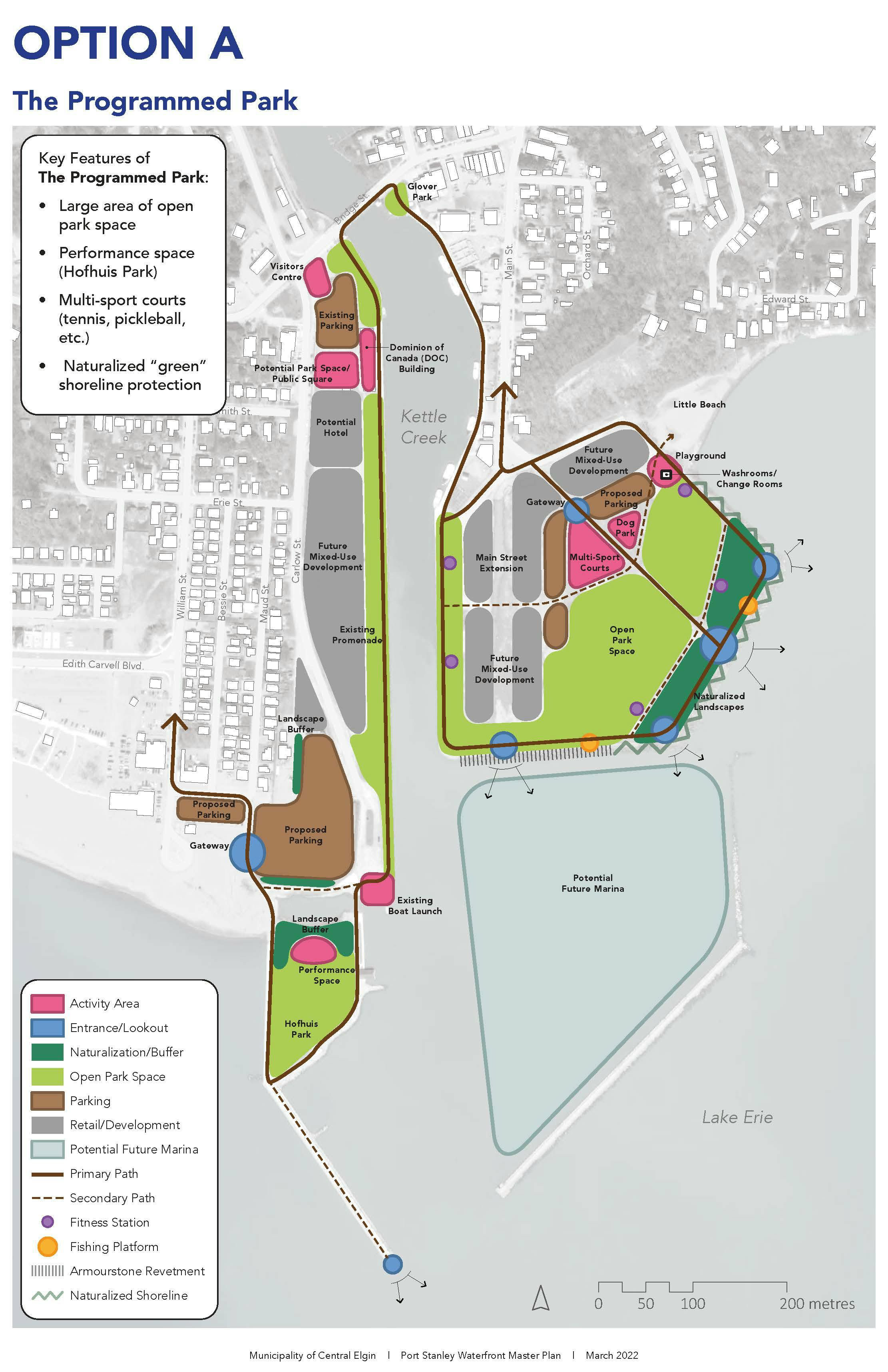
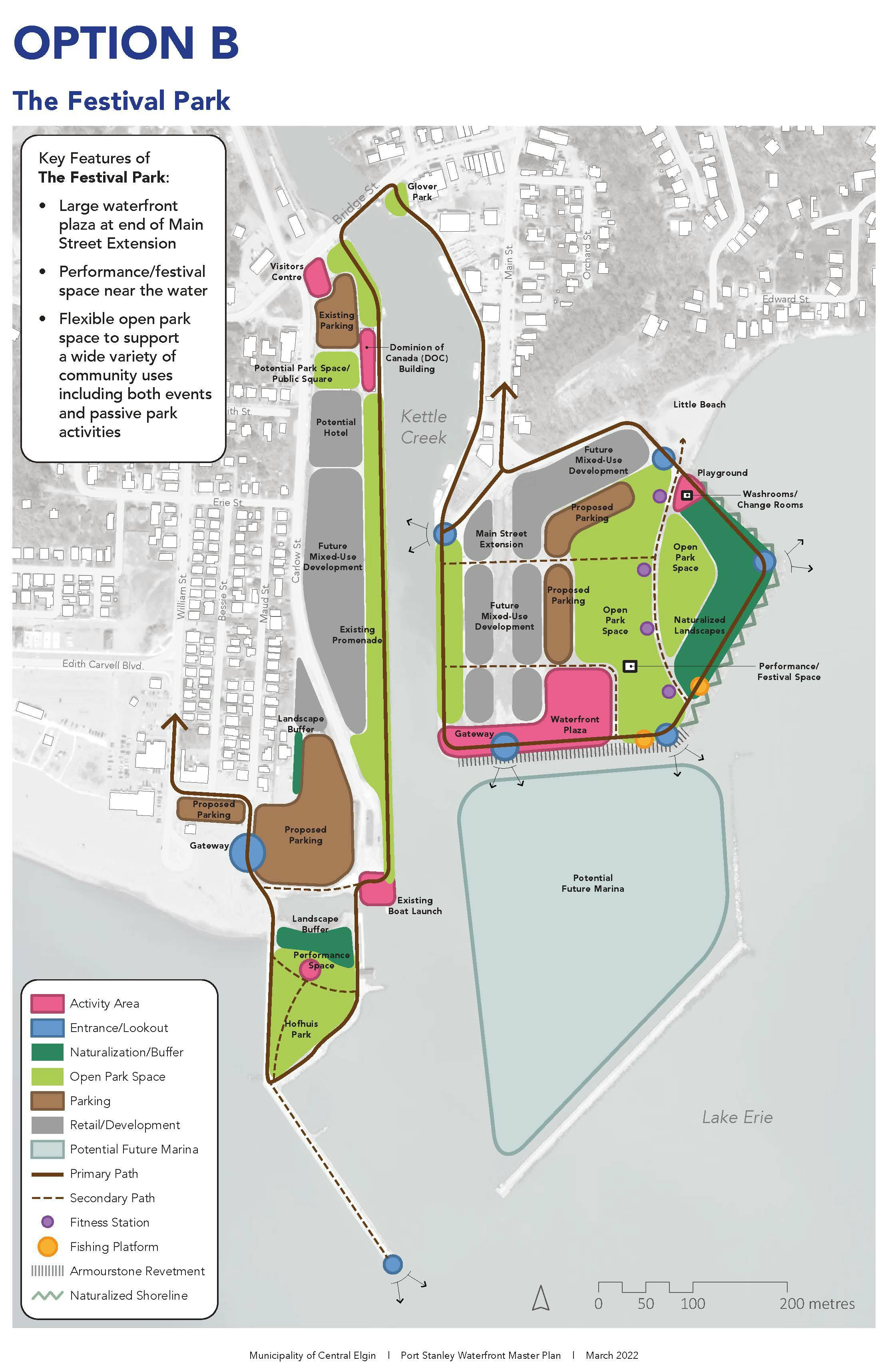
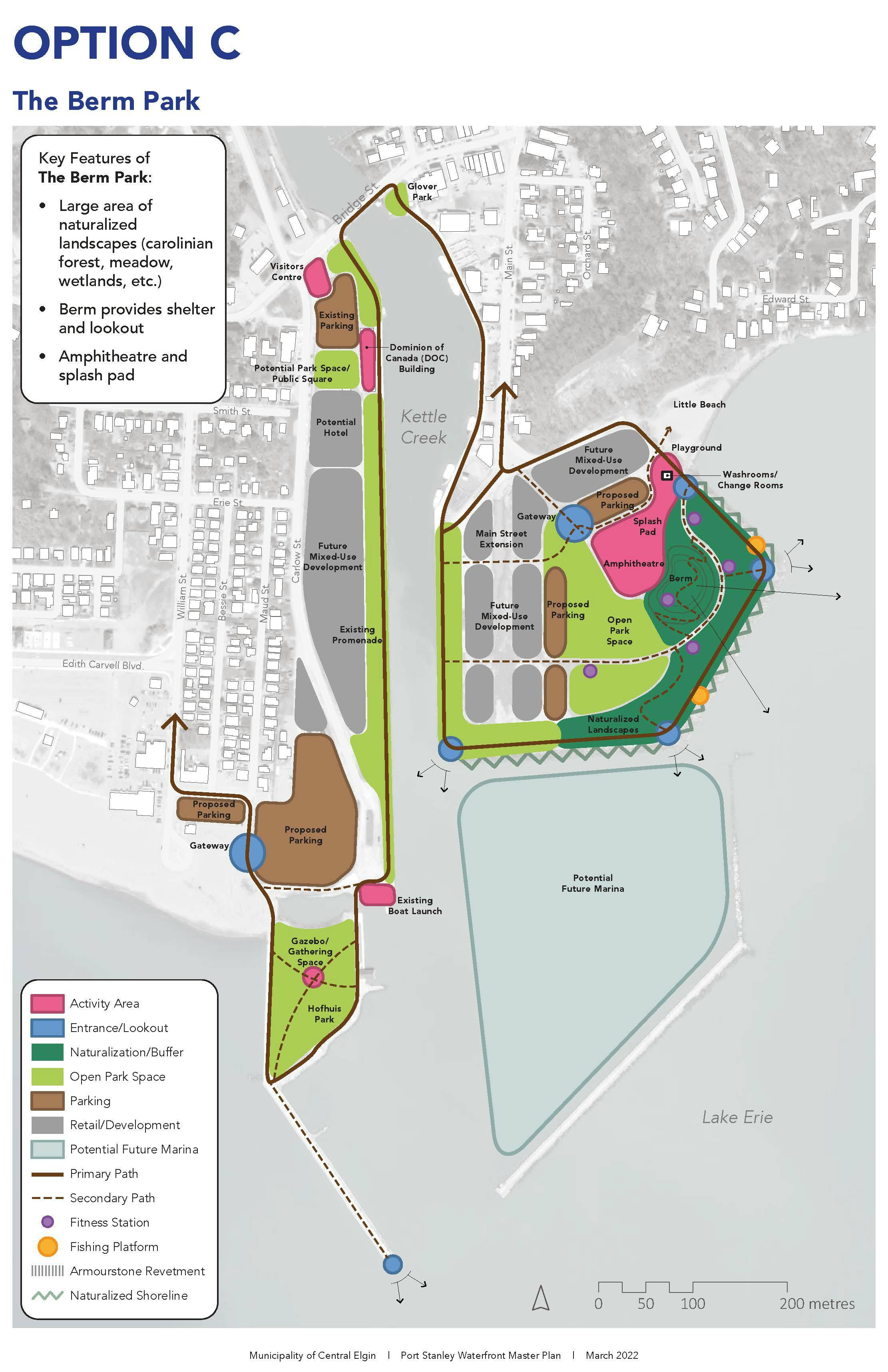
Conceptual Design Options Based On Community Feedback
Document Library
-
 Final Port Stanley Waterfront Master Plan.pdf (5.97 MB) (pdf)
-
Port Stanley Waterfront Master Plans.pdf (8.41 MB) (pdf)
-
June 13 Port Stanley WFMP Presentation.pdf (8.41 MB) (pdf)
-
May 2022 Port Stanley WMP PIC Panels.pdf (12.9 MB) (pdf)
-
May 2022 Port Stanley WMP Background Report.pdf (3.85 MB) (pdf)
-
Thinc Design April 11 2022 Council Presentation.pdf (4.1 MB) (pdf)
-
Precedent Images.pdf (2.08 MB) (pdf)
-
Concept Design Panels for Waterfront Master Plan.pdf (1.3 MB) (pdf)
-
What We've Heard So Far.pdf (258 KB) (pdf)
-
First Public Information Session (January 2022)
-
Official Plan Amendment No. 9 – Port Stanley Harbour Area Secondary Plan (24.2 MB) (pdf)
-
Port Stanley Harbour Area Secondary Plan (19.3 MB) (pdf)
-
Port Stanley Coastal Risk Assessment (16.5 MB) (pdf)
-
Concept Design Panels for Waterfront Master Plan.pdf (1.3 MB) (pdf)
